

Ontario doesn’t hand you a single road trip. It hands you six different provinces’ worth of terrain compressed into one administrative boundary, with driving distances that routinely surprise people who assumed it was a quick loop. The province stretches over 1,700 kilometres from Windsor to the Manitoba border — 17 hours straight on the Trans-Canada if you never stopped once.
The five routes below cover the full range of what Ontario actually delivers. Each has a distinct character, a different ideal traveller, and a specific set of things that go wrong without proper preparation.
Five Ontario Road Trip Routes, Compared Directly
Before committing to any itinerary, understand what each corridor actually costs you in time, money, and logistics. The table maps every major route against the variables that decide whether a trip works.
| Route | Distance | Ideal Duration | Best Season | Best For | Main Risk |
|---|---|---|---|---|---|
| Algonquin & Muskoka Loop | ~750 km | 4–5 days | June–Oct | Families, first-timers | Campsites on Reserve Ontario book out months ahead |
| Lake Superior Circle Route | ~2,800 km | 8–10 days | July–Sept | Long-haul drivers, photographers | Fuel gaps on Hwy 17; no cell signal for 100+ km stretches |
| Niagara to Prince Edward County | ~350 km | 2–3 days | May–Oct | Wine lovers, couples | Friday QEW traffic out of Toronto adds 60–90 minutes |
| Georgian Bay & Bruce Peninsula | ~500 km | 3–4 days | June–Sept | Hikers, snorkellers | Grotto permits and Chi-Cheemaun ferry both sell out months early |
| Northern Ontario Trans-Canada | ~1,400 km | 5–7 days | June–Sept | Solitude seekers | Extremely limited services; moose collisions are a documented fatality risk |
What the Distance Numbers Don’t Show
The Algonquin loop looks manageable at 750 km. It is — but not at highway speeds. Highway 60 through Algonquin Provincial Park runs at 80 km/h with dozens of signed wildlife pull-offs and a culture of slow-moving drivers who are there specifically not to rush. Budget at least two hours for the 55 km gate-to-gate corridor.
The Lake Superior Circle Route looks punishing at 2,800 km. In practice it’s one of the most enjoyable long drives in Canada because the scenery forces you to stop constantly. Most travellers average 250–300 km per driving day not because they’re underprepared, but because you physically cannot drive past Old Woman Bay without pulling over.
Budget Reality for 2026
Ontario road trips are not cheap. Fuel from Toronto to Thunder Bay and back runs roughly $220–$290 in a standard sedan. Provincial park camping costs $42–$62 per night depending on park and site type — Algonquin’s electrical sites book at the higher end. Motels outside major cities run $150–$230 per night for two people on summer weekends. Interior camping and backcountry routes cut accommodation costs sharply but require more lead time and logistics planning.
The Lake Superior Circle Route: Ontario’s Longest and Most Rewarding Drive
Nothing else in Ontario compares to the Lake Superior Circle Route for scenic intensity per kilometre driven. Most people outside the province have never heard of it. That’s part of why it still works — the crowds that have overrun Banff haven’t found this corridor yet.
The route runs north from Sault Ste. Marie along Highway 17, follows the north shore through Wawa, White River, Marathon, and Nipigon, reaches Thunder Bay, then loops back south through Sudbury. You can drive it as a full circle or as a one-way run between Sault Ste. Marie and Thunder Bay if you’re flying into one city and out of the other.
The Stops That Justify the Drive
Pancake Bay Provincial Park, 90 km north of Sault Ste. Marie, has a 3.2 km sandy beach that looks genuinely wrong for a lake this cold and wild. It’s a legitimate first-night stop with campsite availability if you book a few weeks out rather than last minute.
The pull-off at Old Woman Bay — roughly 200 km north of Sault Ste. Marie — requires no entry fee, no reservation, and no infrastructure. A gravel lot sits where the Canadian Shield drops straight into Lake Superior and the water turns a colour most cameras can’t reproduce. Stop here. Spend 20 minutes. It earns its reputation.
Pukaskwa National Park, accessed from Heron Bay, is the most overlooked stop on the route. The Coastal Hiking Trail is a multi-day backcountry route along the Lake Superior shoreline — remote, difficult, and exceptional for experienced hikers. For day visitors, the Southern Headland Trail runs 16 km with enough cliff-edge views to justify the effort.
In Thunder Bay, Sleeping Giant Provincial Park extends southeast into Lake Superior on a peninsula that resembles a reclining human figure from the right angle. The Top of the Giant trail is 9.5 km return, rated difficult, and earns every elevation metre in views. Thirty kilometres west of the city, Kakabeka Falls Provincial Park drops 40 metres on a 1.5 km accessible loop — worth an hour, easy to tack onto an afternoon.
What Makes Highway 17 Genuinely Dangerous
Three things most trip reports understate.
First: fuel. Between White River and Wawa — about 105 km — gas stations don’t keep consistent hours outside July and August. Fill your tank whenever it drops below half. People run dry on this stretch every summer without exception.
Second: cell coverage. Stretches of 80–120 km with no signal are normal. Download offline maps before leaving Sault Ste. Marie — Google Maps works for this, and Maps.me has stronger detail in remote corridors. File a trip plan with someone who knows your expected checkpoints.
Third: moose. Collisions with moose are frequently fatal in standard passenger vehicles. A moose’s legs shear off at bumper height and the body enters through the windshield. Avoid driving the northern stretches between dusk and dawn. This is not an exaggeration offered for effect.
Georgian Bay and the Bruce Peninsula: The Best Short Route in Southern Ontario
Three to four days, 500 km, and the highest scenic return per kilometre of any Southern Ontario corridor. Drive from Toronto north to Collingwood, then up the Bruce Peninsula to Tobermory. The Grotto at Bruce Peninsula National Park requires a day-use reservation through Parks Canada’s online system — these sell out by March for summer weekends, so book the moment the season opens in winter. In Tobermory, the Blue Heron Company runs glass-bottom boat tours through Fathom Five National Marine Park, where 19th-century shipwrecks sit in 10–20 metres of underwater visibility — freshwater snorkelling that compares favourably with ocean sites. If you want to extend the route, the Chi-Cheemaun ferry from Tobermory to South Baymouth crosses to Manitoulin Island; book the ferry months ahead in summer, as it runs at capacity from late June through August and does not hold space for walk-ons.
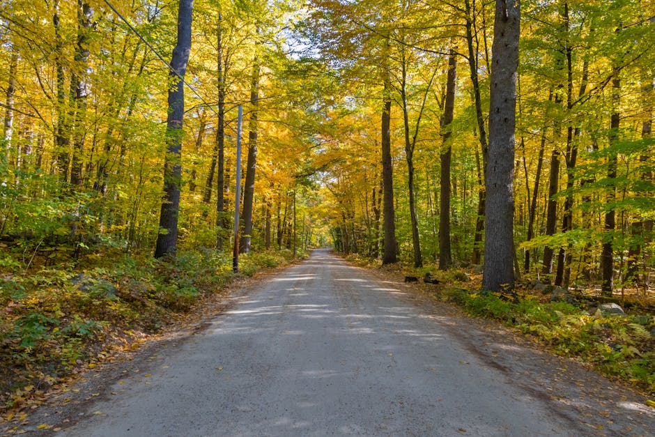
Planning the Algonquin and Muskoka Loop Without the Predictable Mistakes
This is the right first Ontario road trip for most people. Four to five days, manageable distances, reliable services, and the lakeland and Shield landscape that defines what most visitors picture when they think of this province. But it has specific failure modes that catch first-timers every summer.
The Route, Day by Day
- Day 1: Toronto to Huntsville, 215 km, approximately 2.5 hours without traffic. Collect canoe equipment from Algonquin Outfitters at their Oxtongue Lake location — book this ahead, especially in peak season. Check into accommodation on Peninsula Lake or in Huntsville town.
- Day 2: Enter Algonquin at the West Gate on Highway 60. Paddle Canoe Lake in the morning — this is where Tom Thomson painted and died in 1917 and the lake retains a genuine atmosphere that photos don’t fully translate. Drive east to the Visitor Centre at km 43 for ecology context. Camp at Mew Lake or Rock Lake if you secured a reservation.
- Day 3: Drive east to the Barron Canyon Trail — 1.5 km return, with canyon walls dropping 100 metres into the Barron River. It’s unlike anything else accessible in Southern Ontario and takes under two hours round trip including time at the rim. Exit via the East Gate and drive toward Barry’s Bay or Bancroft for the night.
- Day 4: Loop back through Haliburton. Less crowded than Muskoka, better swimming, no tour boats. Return to Toronto via Highway 35 south — a mid-afternoon arrival if you leave Haliburton by 10 AM.
The Booking Mistakes That Actually Derail This Trip
Interior campsites in Algonquin book through Reserve Ontario at reserveontario.ca, and the summer season opens for reservations in January. By February, the best sites are taken. If you’re planning July or August and it’s already May, pivot to car camping at Mew Lake or Rock Lake — more availability, still excellent, but book weeks ahead for weekend dates.
The secondary mistake: driving north from Toronto on a Friday afternoon in July. The Highway 400 cottage country bottleneck adds 60–90 minutes to what should be a 2-hour drive. Leave Thursday evening or Saturday morning and the road takes half the time for the same destination.
One more detail: Ontario provincial parks require a vehicle entry permit — a day permit costs $21 or an annual permit runs $123 for 2026. Conservation officers check along Highway 60 regularly. A campsite reservation does not cover your vehicle permit for driving the corridor.
Seasonal Windows: When Each Route Actually Works
Is Fall the Best Time for Ontario Road Trips?
For the Algonquin loop and Georgian Bay routes, yes — late September and early October hit the fall foliage peak without summer crowds. Temperatures run 8–18°C during the day. Black flies are gone. Campgrounds are quieter and often cheaper. The single caveat: many provincial campgrounds close after Canadian Thanksgiving weekend, which falls on the second Monday of October. Verify open dates on Reserve Ontario before assuming a site is accessible past that point.
What About Driving in Peak Summer?
July and August are the most expensive, most crowded, and most logistically demanding months. The practical fix is simple: structure your travel dates Tuesday through Thursday wherever possible. The Grotto at Bruce Peninsula on a Wednesday morning is a genuinely different experience from the same location on a Saturday at noon. Same water. Very different lineups.
Can You Road Trip Northern Ontario in Winter?
The Southern Ontario routes — Niagara to Prince Edward County, the lower Georgian Bay section — are reasonable year-round with proper winter tires. The Northern Ontario routes are a different category entirely. White-out conditions on Highway 17 along Lake Superior are not unusual in February. The lake-effect snow corridor between Wawa and White River is one of the snowiest in the country. Unless you have genuine experience driving in serious winter conditions and a vehicle prepared for them, the Lake Superior Circle Route and the Trans-Canada north of Sudbury are summer and early fall drives only. The one exception worth knowing: Algonquin Park in January is excellent for cross-country skiing on the Minnesing Trail system, and the park in winter delivers a solitude impossible in summer — just drive only in daylight and check road conditions on the Ontario 511 app before departure.
Book campsites and permits in January, leave on weekdays instead of Fridays, and fill your tank whenever it drops below half — those three habits account for the majority of what actually goes wrong on Ontario road trips.


