Most people think the Cares Gorge hike is a flat, easy walk through a pretty canyon. That’s wrong. It’s 12 kilometers of narrow trail carved into a vertical cliff face, with sheer drops to your left and rock walls to your right. No shade. No water fountains. No escape route once you’re in the middle. I walked it last September, and the first thing I noticed was how many people were completely unprepared — sandals, one small water bottle, no hat, and a look of panic by kilometer 3.
This article covers what I wish someone had told me before I started. Real distances, real conditions, and the specific gear that makes the difference between a great day and a dangerous one.
What the Cares Gorge Hike Actually Is (And Isn’t)
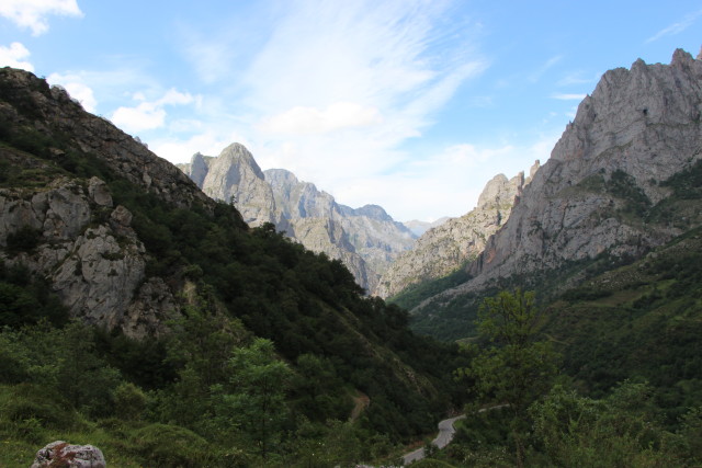
Let’s clear up the biggest myth first. The Ruta del Cares — often called the Divine Gorge — is a point-to-point trail between the villages of Poncebos and Cain. Total distance: 12 kilometers one way (24 km round trip if you walk back). Elevation gain: roughly 120 meters. That sounds flat, but the trail is uneven limestone with loose gravel, exposed sections, and narrow passages where two people cannot pass side by side.
The trail was originally built to maintain a water channel for a hydroelectric plant. That’s it. A maintenance path. It was never designed for tourism. The path is about one meter wide in most sections, with a drop of 200 to 500 meters straight down into the gorge. No railings. No barriers.
I met a couple from Madrid who had read it was “easy” and brought their 4-year-old in a stroller. They turned back after 500 meters. Smart decision.
Why People Get This Wrong
Travel blogs and Instagram posts show smiling people on wide sections with blue sky behind them. They don’t show the narrow ledges, the sections where the path crumbles at the edge, or the 30-minute stretches with zero shade in 35°C heat. Search “Cares Gorge” online and you’ll see dozens of articles calling it “the easiest hike in Picos de Europa.” That’s marketing, not reality.
The hike is moderate difficulty for someone in decent shape with proper footwear. It’s not technical — no scrambling, no climbing. But it requires sustained attention for 3-4 hours each way. One wrong step on loose gravel and you’re looking at a broken ankle or worse.
When to Actually Go
June through September is the main season. I went in mid-September. Temperature was 28°C in the sun, comfortable in the shade. July and August are hotter and busier. The trail gets crowded — you’ll pass dozens of groups going both directions. That slows you down and makes the narrow sections more stressful.
May and October are cooler but riskier. Rain makes the limestone slippery. Snow can linger on higher sections into early June. The path stays wet for days after rain. If you go in shoulder season, check the forecast for 72 hours before your hike, not just the morning of.
Start early. The first bus from Poncebos to Cain leaves around 7:30 AM. Take it. You want to be walking by 8:00 AM at the latest. By 11:00 AM, the sun hits the gorge floor and the heat becomes real. By 1:00 PM, you’re sharing the trail with everyone who slept in.
The Gear That Actually Matters (And What to Leave Behind)
I saw people hiking in Vans slip-ons, canvas sneakers, and one guy in leather loafers. This is a trail where ankle support and grip matter. The surface is sharp limestone that will cut through thin soles. I wore Salomon X Ultra 4 Mid GTX boots ($175). They have a deep lug pattern that held on loose gravel, and the Gore-Tex lining kept my feet dry when I crossed a small stream section. A friend wore Merrell Moab 3 Ventilators ($130) — also fine, but the low-cut version offers less ankle support on uneven ground. Don’t wear trail runners unless you have strong ankles.
| Item | Why You Need It | What I Used |
|---|---|---|
| Boots with ankle support | Loose gravel + uneven surface = rolled ankles | Salomon X Ultra 4 Mid GTX |
| 2 liters of water minimum | No water sources on trail. 3+ hours in heat. | Platypus DuoLock 1L bottles (x2) |
| Sun protection | Zero shade for 70% of the hike | Buff UV neck gaiter + Sunday Afternoons Ultra Adventure Hat |
| Snacks with salt | You sweat a lot. Electrolytes matter. | Trail mix + salted almonds + electrolyte tablets |
| Headlamp | If you get delayed, tunnels are pitch black | Petzl Tikka ($30, 300 lumens) |
What to leave at the hotel: jeans (too heavy when wet), cotton shirts (stay wet, cause chafing), a backpack over 25 liters (you don’t need that much space), hiking poles (they’re more trouble than help on narrow sections — you’ll hit other hikers).
The One Item Nobody Tells You About
Electrolyte tablets. I brought Nuun Sport tablets ($8 for a tube of 10). Dropped one in my water at the halfway point. That single thing prevented the headache and cramping I saw in other hikers by kilometer 8. You lose salt fast when hiking in direct sun. Water alone won’t fix it. A tube weighs nothing. Bring it.
The Two Biggest Mistakes People Make
I watched these happen in real time. Don’t be the person who makes them.
Mistake 1: Not Planning the Return
The trail goes from Poncebos to Cain. Most people assume they can just walk back. They can. But by the time you reach Cain, have lunch, and start walking back, it’s 2:00 PM. The sun is directly overhead. You’re tired. Your feet hurt. The return leg feels twice as long as the outbound. I saw multiple groups sitting on rocks near the end, out of water, looking miserable.
The fix: Take the bus from Poncebos to Cain first thing in the morning. Walk downhill from Cain to Poncebos. The elevation difference is only 120 meters, but walking north to south means the sun is behind you in the afternoon. Alternatively, arrange a taxi to pick you up in Cain. Cost: about €25-30. Split between 4 people, that’s nothing. Do it. Your legs will thank you.
Mistake 2: Underestimating the Mental Game
This is not a technical hike. But it is mentally draining. The trail looks the same for hours. Cliff wall on your right, drop on your left. No landmarks. No variety. After 90 minutes, your brain starts to wander. That’s when people step too close to the edge or trip on a loose rock. I saw a woman in her 50s stumble and catch herself with one hand on the cliff face. She was fine. She also looked terrified.
The fix: Set small goals. Pick a tunnel entrance, a bridge, a specific rock formation. Walk to it, take a sip of water, reset your focus. Don’t look at the drop. Look at the path 2 meters ahead of your feet.
How the Hike Actually Breaks Down (Kilometer by Kilometer)
Here’s the real pacing. I walked from Cain to Poncebos (south to north) starting at 8:15 AM. Finished at 11:40 AM. That’s 3 hours 25 minutes moving time, with two 5-minute breaks.
- Kilometers 0-3: Gradual descent from Cain into the gorge. Wide path, good views. Easy. You’ll feel confident. Don’t let that fool you.
- Kilometers 3-6: The narrowest sections. Path width drops to under 1 meter in places. You’ll pass through several short tunnels — bring that headlamp. The ground is uneven limestone with sharp edges. Watch your ankles.
- Kilometers 6-9: The mental grind. You’ve been walking 2+ hours. The scenery hasn’t changed much. The sun is getting higher. This is where you’ll see people sitting down, looking tired. Keep moving. Drink water. Eat a snack with salt.
- Kilometers 9-12: The path widens again as you approach Poncebos. You’ll see the bridge and the parking lot. The last kilometer feels longer than the first five. Push through.
Total water consumed: 1.75 liters. I started with 2 liters. I was thirsty at the end but not dehydrated. If you’re larger than me (I’m 75kg) or hiking in July, bring 2.5 liters minimum.
Alternatives to the Full Out-and-Back
Not everyone needs to do the full 24 km. Here are three better options depending on your situation.
Option 1: The One-Way with Taxi Return
Park at Poncebos. Take the 7:30 AM bus to Cain (€3). Walk back to Poncebos. Total hiking distance: 12 km. Takes 3-4 hours. You see the entire gorge without the punishment of walking back the same way. This is what I recommend for 90% of hikers. Cost: €3 for the bus, or €25-30 for a taxi if you miss the bus.
Option 2: The Short Walk from Poncebos
Walk 3 km into the gorge from Poncebos, turn around, walk back. Total: 6 km. You see the dramatic entrance, the bridge, and the first tunnels. You avoid the long middle section that looks the same for hours. This is the right choice if you’re with kids under 12, if you have mobility issues, or if you just want photos and a nice morning walk. Don’t feel bad about skipping the full route.
Option 3: Skip It Entirely and Do the Ruta de la Vega de Ario Instead
If you don’t like exposed cliffside trails, if you have a fear of heights, or if you’re hiking in wet weather, don’t do the Cares Gorge. Do the Ruta de la Vega de Ario instead. It’s a 10 km loop starting from the Lagos de Covadonga. You get alpine lakes, green meadows, and views of the Picos peaks — without the sheer drops. It’s easier, more varied, and safer in bad weather. The Cares Gorge will still be there next year.
Bottom line: The Cares Gorge is worth doing exactly once. Do it right — proper boots, enough water, early start, and a plan to get back without walking both ways. If you do that, you’ll have a great day. If you show up in sneakers with one bottle of water at 11 AM, you’ll have a bad one. The choice is yours.